Major flood of B.C.’s Fraser River could cause billions in economic losses: ICLR speaker
April 18, 2018 by Jason Contant
Print this page Share
A major flood of British Columbia’s Fraser River or a coastal flood between now and 2100 could trigger economic losses of between $20 billion and $30 billion, a recent flood strategy report found.
Released in 2016, Phase 1 of the Lower Mainland Flood Management Strategy showed that there is a “significant risk” of a large-magnitude flood in the province’s Lower Mainland. That risk is projected to worsen over the next 85 years, both in terms of flood frequency and size, due to sea level rise and other projected impacts of climate change.
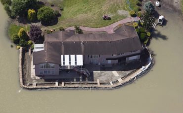
A sandbag dike holds back the water from the Fraser River in Chilliwack, B.C., on June 28, 2012. A major flood of B.C.’s Fraser River could impact as many as 2.2 million people, devastating residents, destroying First Nations’ lands and putting a damper on the province’s economy. Groups representing many of those interests are now developing a comprehensive flood plan, recognizing that the Lower Mainland is highly vulnerable to river and coastal flooding, and that climate change means the risk of a disaster will increase. THE CANADIAN PRESS/Jonathan Hayward
Steve Litke, senior program manager, watersheds and water resources with the Fraser Basin Council, told Canadian Underwriter in an interview Wednesday that the study looked at large, regional scale floods, such as those on the Fraser River and coastal flooding, as opposed to localized, heavy rainfall-type or sewer backup events.
The study examined both present-day flood events as well as the effects of climate change projecting out to 2100. The $20-30 billion estimates were mostly direct losses, Litke said, including impacts to buildings, infrastructure and the agriculture sector. “A fairly conservative estimate,” he said, adding that the study “didn’t look very deeply at indirect economic losses related to damage and disruption of critical infrastructure.”
Litke will be discussing the results from Phase 1 at the Institute for Catastrophic Loss Reduction (ICLR)’s next Friday Forum webinar on April 20. He will also be speaking about work current underway in Phase 2, such as floodplain modelling in progess, as well as flood mitigation planning in B.C.’s Lower Mainland, an area of more than 25 municipalities stretching from Hope in the east to Vancouver (west) to White Rock (south) to Squamish (north). In Phase 3, expected to begin in 2020, the Phase 2 final report and recommendations will be implemented.
The webinar will be held from 1 p.m. to 2:30 p.m.
One of the major flood hazards in the Lower Mainland is from the Fraser River. “For some of the floodplain areas of the Fraser, people might experience two or three or four metres of floodwater,” Litke noted, adding that one area of the lower Fraser River used to be a lake that was drained. While there is a pretty heavy reliance on flood protection diking systems in the Lower Mainland, “if there was a failure in the diking system, that lake would refill,” he said.
The webinar will also discuss flood mitigation strategies, which include:
- Diking systems and flood proofing: guiding growth out of flood-prone areas or building habitable building space above predicted floodplain levels. “So if there is a flood, there is reduced damages,” Litke said;
- Sediment management;
- Upstream storage (the upstream floodplain may store a significant amount of water so that downstream dikes may not fail); and
- Nature-based solutions, such as setting back dikes to leave more room for the river.
Have your say: