
With severe storms inching into the Chicago area, what you will see and when depends on where you are in the region.
Already, tornado watches and severe thunderstorm warnings have been issued in parts of the region, while elsewhere in Illinois, numerous tornado warnings have sparked.
Stream NBC 5 for free, 24/7, wherever you are.
So what can you expect and when?
Here's the latest:
Storm Timing
Around 12 p.m., stronger showers and storms were expected develop starting in McHenry County and through parts of DeKalb, Aurora and Romeoville. To the south, including in Will, LaSalle and Grundy Counties, even stronger storms will develop, according to the NBC 5 Storm.
By early afternoon, those storms were moving into northwest Indiana.
Later in the afternoon, between 3 p.m. and 5 p.m., showers to the west will move eastward.
Feeling out of the loop? We'll catch you up on the news you need to know with the Chicago Catch-Up newsletter.
"Heavy rain is possible for the afternoon commute," Meteorologist Alicia Roman said.
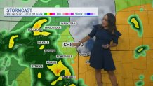
According to the National Weather Service, the entire Chicago area is under a severe weather threat, though the strongest storms may only impact certain parts.
Far north and northwest Lake County will be under a "marginal" risk of severe weather, which ranks as level one of five on the Storm Prediction Center's scale. Parts of southern Lake County, along with Central Cook and areas to the southwest will be under a "slight" risk, which ranks as level two.
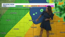
In the southeastern counties and in northwest Indiana is where the strongest storms could hit, Roman said, with those parts under an "enhanced" risk of severe weather.
"Some of these storms may be severe, especially along and southeast of I-55 across eastern Illinois and northwest Indiana," the NWS warned. "Damaging winds, large hail and tornadoes are possible, in addition to locally heavy rainfall."
Flights departing for Midway Airport were held at their originating airports for more than an hour due to the threat of severe weather, but that stop was lifted just before 2 p.m.
At Chicago’s O’Hare International Airport, there is a ground delay in place, with an average delay of nearly two hours in departing flights because of severe weather.
Severe Weather Alerts
A tornado watch has been issued for Grundy, Will and Kankakee counties in Illinois until 7 p.m., along with Lake, Porter, LaPorte, Newton and Jasper counties in Indiana.
A flash flood watch is also in effect for LaSalle, Kendall, Grundy, DuPage, Cook, Will and Kankakee counties in Illinois. A warning has been issued in Kankakee County, with rainfall rates of three inches per hour possible.
Multiple tornado warnings have already been issued in western and central Illinois, including one for a confirmed tornado near Jacksonville.
Other alerts include: (This list was last updated at 2:15 p.m. Check here for the most recent alerts)
Tornado Watch
- Lake County, IN
- Grundy County, IL
- Will County, IL
- Kankakee County, IL
- Porter County, IN
- LaPorte County, IN
- Newton County, IN
- Dubois County, IN
Flash Flood Warning
Severe Thunderstorm Warning
Flood Advisory
Flood Watch
- DuPage County, IL
- Central Cook County, IL
- La Salle County, IL
- Kendall County, IL
- Grundy County, IL
- Northern Will County, IL
- Kankakee County, IL
Biggest Threats
According to NBC 5 Storm Team 5 Meteorologist Alicia Roman, the storms could bring damaging winds, quarter-size hail and possibly even the chance for tornadoes, but one of the largest threats could be flooding in portions of the area.
The showers and storms pushing toward the Chicago area were already producing eye-popping impacts as they neared the region.
A weather station in Chatsworth, located in Livingston County, reported 2.55 inches of rainfall within a span of just 90 minutes. Storms located on a line extending from Roselawn to Wolcott to Brookston, were moving northeast at a staggering 75 miles per hour and packing wind gusts in excess of 70 miles per hour.
Multiple tornado touchdowns were reported by weather spotters in Illinois.
According to the latest reports from the University of Michigan’s Climate and Space Sciences and Engineering school, at least four tornadoes have been reported in areas to the west of Springfield.
Two of those tornadoes were reported near the community of Jacksonville, with other touchdowns reported in Literberry and Philadelphia.
Another tornado was reported near the town of Mason City, approximately halfway between Peoria and Springfield in central Illinois.
Live Radar
Track the storms live as they near the Chicago area in the player above and below:
What else to know
While temperatures will remain in the low 80s Thursday, extremely muggy and humid conditions will also be in place, making the air feel even warmer.
Heat and humidity levels will increase heading into the weekend, the NWS said, when heat indices could reach 100 degrees or higher, lasting "several days in a row."
As a result, the city of Chicago will activate its emergency cooling centers over the weekend, the Chicago Office of Emergency Management and Communications said.