The first forecast trends for Summer 2025 show a dynamic summer pattern in the atmosphere over North America. What stands out is a trend for an unsettled weather pattern across the eastern United States, likely produced by a pressure disturbance, not yet resolved in the current forecasts.
When trying to understand any weather season and long-range forecasts, we must realize that many global factors can influence weather patterns.
So, while we will look at the first long-term trends for the Summer, we do have to keep in mind that these are not fixed scenarios. But they will give us a general idea of what early predictions show for Summer 2025 over the United States and Canada.
WARM SEASON TRANSITION PERIOD
Before looking at the summer predictions, we will first look at the latest forecast for Spring. More specifically, we will look at the transition period from Spring to early Summer (April-May-June).
The 3-month pressure anomaly forecast for this period indicates a low-pressure area over western Canada and a low-pressure axis over eastern Canada. A high-pressure zone is indicated over the western United States.
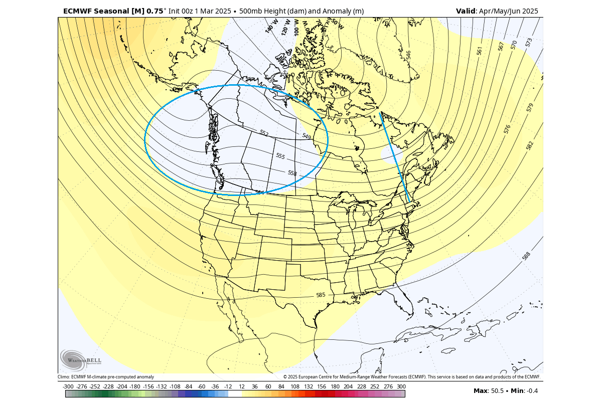
As this is a 3-month average, those two low-pressure zones over Canada are likely not going to be present at the same time. But their signal is present in the average over the whole 3-month period.
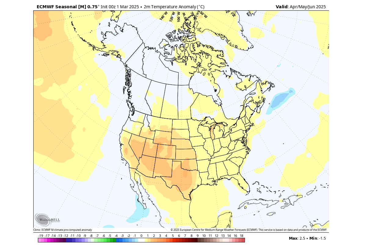
Looking closer at the temperature pattern in this period, you can see the larger area of warm anomalies over the western and southwestern United States under the high-pressure zone. We don’t see any unusual anomalies over the eastern United States and Canada, indicating normal temperatures in this whole period.
In the precipitation forecast, you can see that most of the western and west-central United States show less rainfall than usual for the April-June period. But you can see more rainfall is forecast over the eastern United States and much of southern and central Canada.
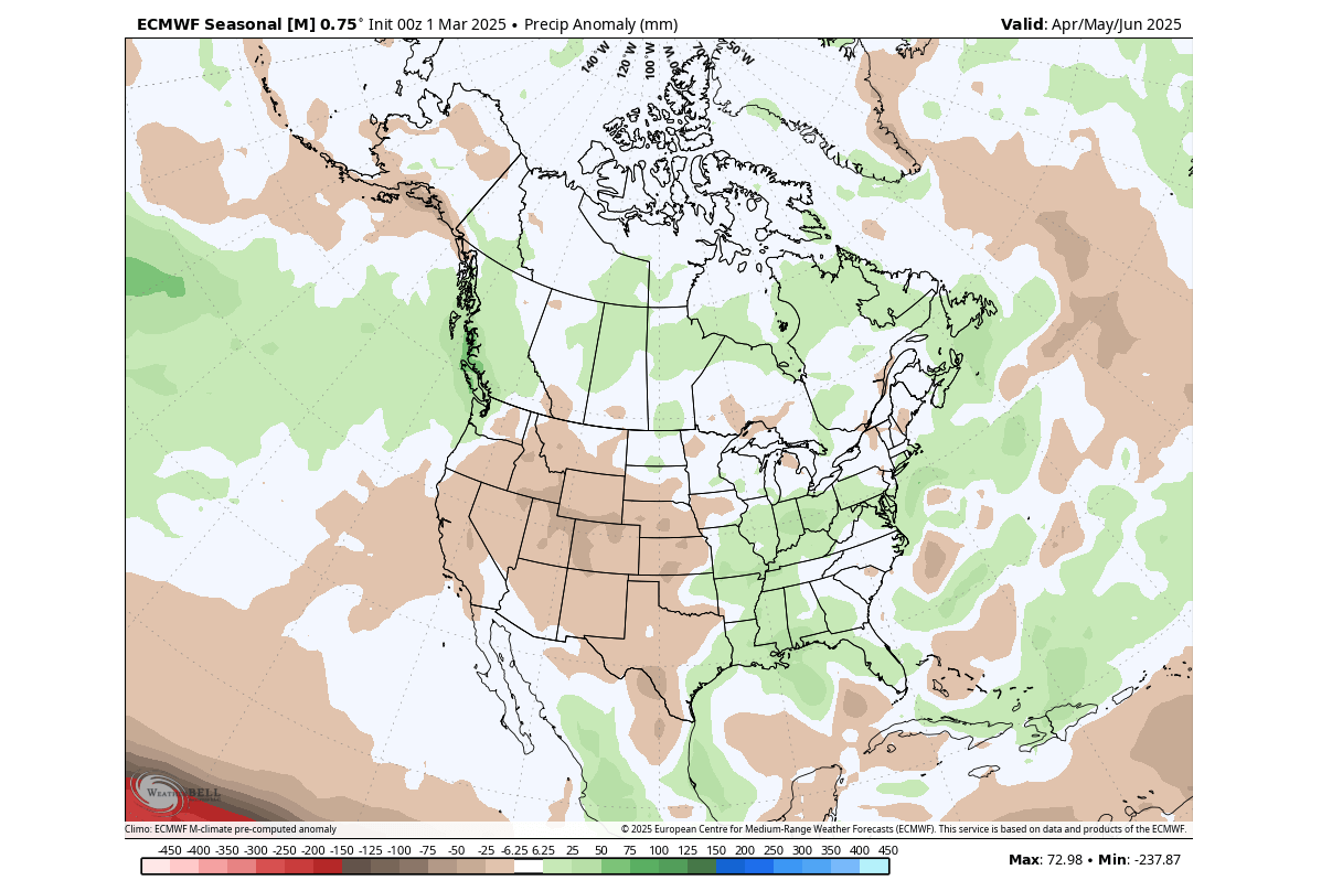
Overall, we can see the Spring-Summer transition will be quite vibrant across the United States: stable/drier conditions over the western U.S., and lower pressure brings normal temperatures and more rainfall over the east.
One of the atmospheric players that will slowly lose its influence in the Spring is the outgoing La Niña anomaly in the Pacific Ocean.
LA NINA BREAKDOWN UNDERWAY
The El Niño and La Niña we mentioned are just opposite faces of the ENSO, which stands for “El Niño Southern Oscillation.” This is a region of the Pacific Ocean that periodically shifts between warm and cold phases. Typically, there is a phase change around every 1-3 years.
La Niña is the cold phase of this ocean anomaly, and a weak La Niña event was active over the winter season 2024/2025 and is now slowly dissipating.
Below is the latest ocean analysis with the main ENSO regions marked in the image. You can see that colder-than-normal waters are present across the central Pacific region, a signature of the La Niña. But towards the eastern region, an unusually warm anomaly has recently emerged.
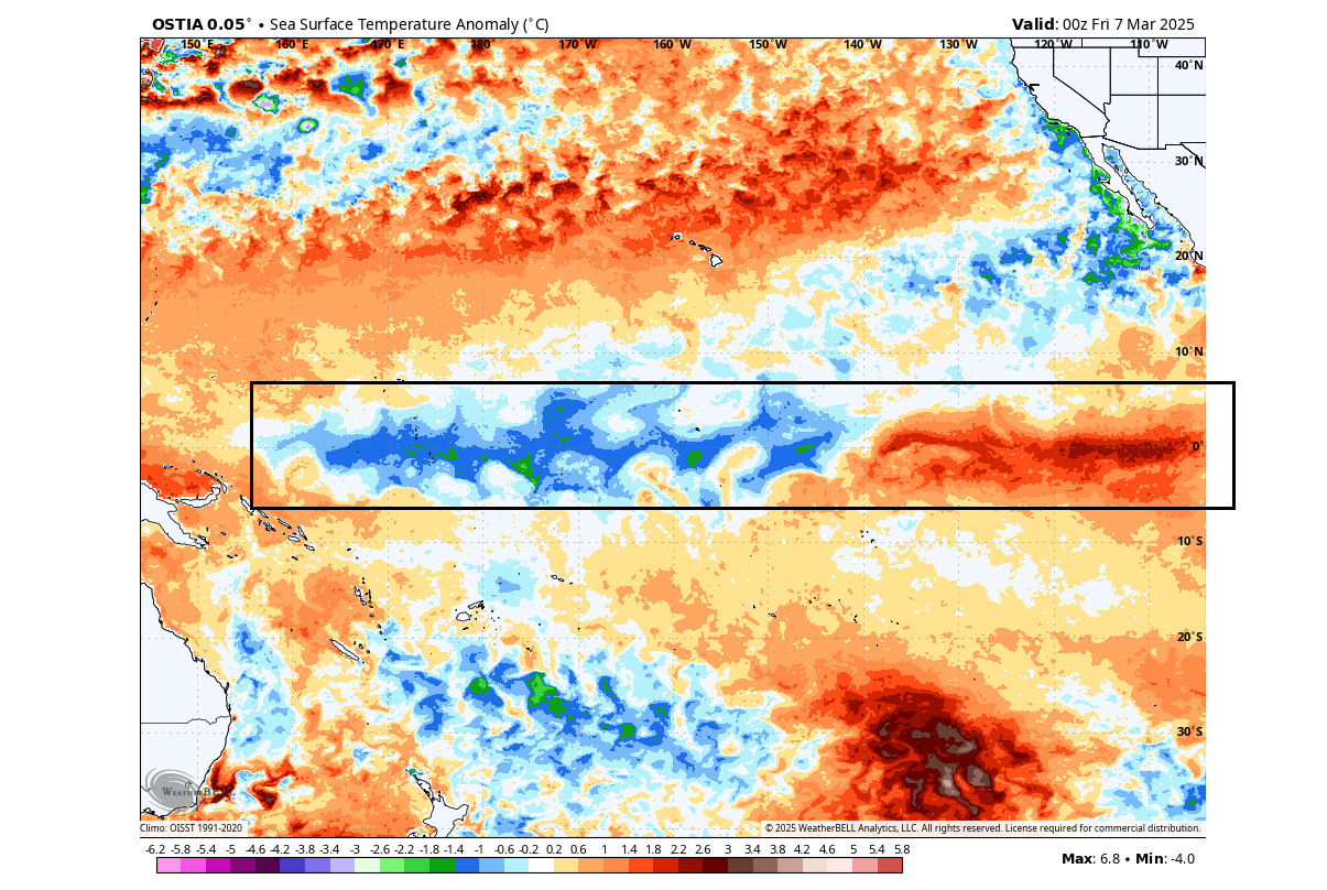
A stronger cooling phase has been ongoing since early December. That has produced the still visible cold “wave” shapes, which are from the trade winds pushing the surface waters.
But as also seen in the image above, warm anomalies are growing in the eastern ENSO region, driven by a westerly wind anomaly. This has started the downfall of La Niña, which still has a healthy cold area in the central parts.
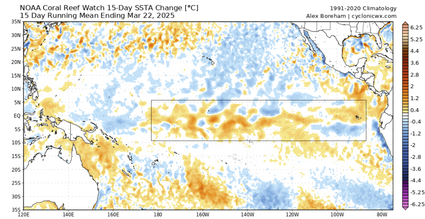
Below is an image that shows the 15-day temperature change across the Pacific Ocean, where you can see the recent temperature changes in the region. The image shows a breakdown of the usual cold anomalies as the La Niña is getting weaker.
Looking closer at the anomalies in the past month, we produced a video from the official weekly ocean analysis. The video below shows a rapid spread of warm anomalies in the eastern regions, pushing the cold out and into the central parts. This video was produced with images from cyclonicwx.com
The long-range ensemble forecast below shows the forecast for the main ENSO region. The La Niña conditions (below -0.5) will disappear during spring. You can see that the extended range shows a neutral phase over the Summer. A lot of ensemble members are moving into the warm anomalies and also above the 0.5 threshold of the El Niño event for the cold weather season.
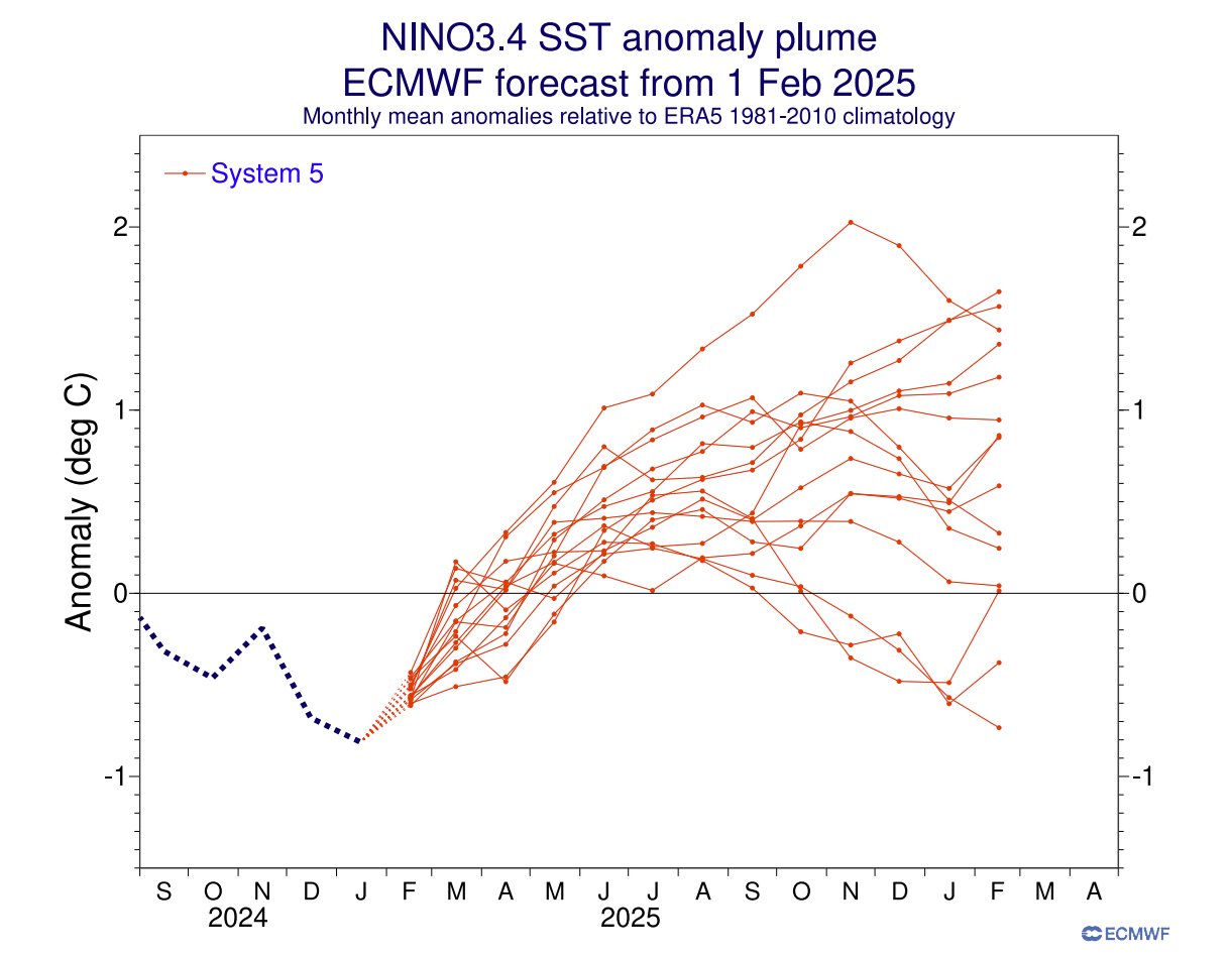
But these anomalies involve more than just ocean surface temperatures. In the big picture, there are also wind patterns and subsurface anomalies at play.
This forecast tells us that we will see little to no influence from the ENSO region during the Summer, so there is no real past weather pattern that we can use to compare with the Summer forecasts.
JUNE 2025 FIRST FORECAST FOR NORTH AMERICA
We will examine the first long-range trends from the ECMWF forecasting system. This is statistically a better long-range model, so we usually start with its forecasts for the early trends.
Generally, the ECMWF model is at the top as far as “reliability” goes. But no long-range/seasonal forecasting system can be called “reliable“. This is because we only look at trends and how the weather patterns are evolving on a large scale and over longer periods.
The forecast period we will focus on is June-July-August. This period covers the meteorological Summer and is the peak of the warm season and the warmest 3 months of the year in the Northern Hemisphere.
Starting with June, you can see the pressure pattern forecast below. There is a low-pressure zone indicated over northern Canada and perhaps over the southern half of the United States. In between, you can see a belt of high-pressure anomalies.
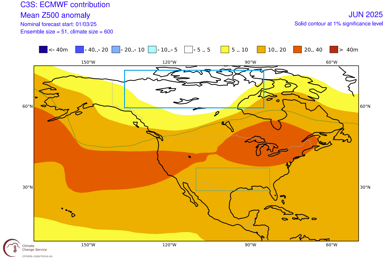
A high-pressure zone over the Great Lakes can create a more easterly flow into the eastern United States. That is because high-pressure systems spin clockwise, creating an easterly flow from the Atlantic.
Looking closer at the June temperature pattern, you can see the reduced warm anomalies over the eastern United States. This also indicates a potential easterly flow from the Atlantic, keeping the temperatures in more normal ranges over the eastern United States in early Summer.
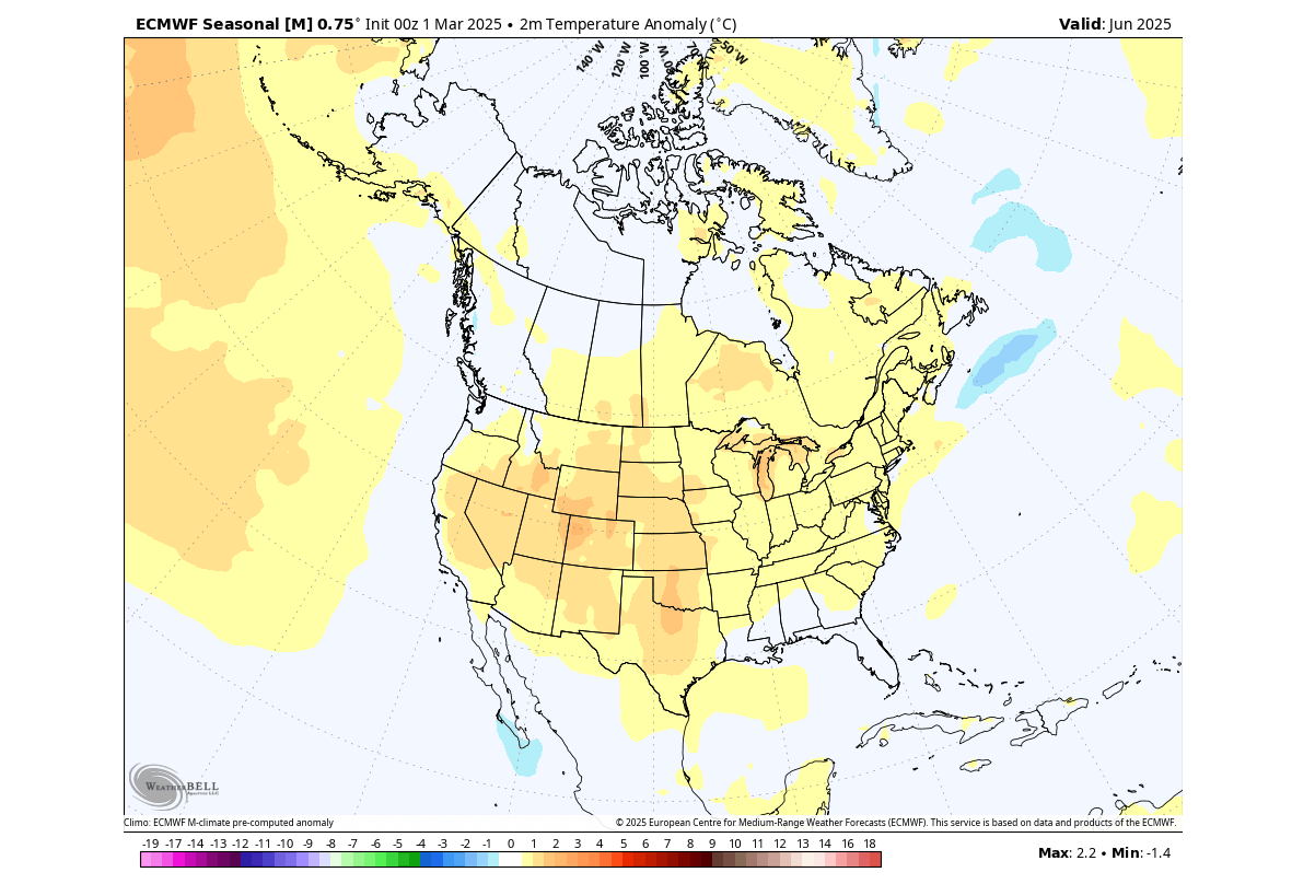
The rest of the United States shows above-normal temperatures, especially over the western and northern parts and the southern Plains. Above-normal temperatures are also forecast over south-central Canada, while the Pacific Northwest shows mostly normal temperatures for June.
The precipitation forecast also indicates a moisture flow over the eastern United States, likely from the indicated easterlies from the Atlantic. We see more rainfall over the eastern and southeastern United States for June, and also over parts of central Canada.
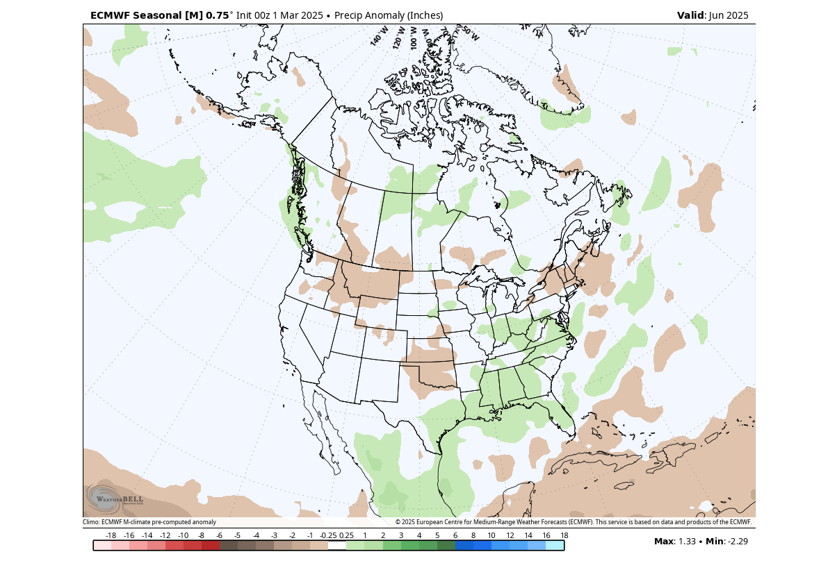
Less rainfall than usual is forecast over the southern Plains, the northern and northeastern United States, and parts of deep southern Canada.
JULY 2025 FIRST FORECAST FOR NORTH AMERICA
July is the second month of meteorological Summer in the Northern Hemisphere and is also the month with the highest temperatures in the long-term average over the United States and Canada.
The July 2025 first pressure forecast shows a low-pressure area over northern Canada. One high-pressure zone is forecast over the Pacific Northwest and one over the northeastern United States. There is no low-pressure actually forecast, but we do see a gap between the two high-pressure systems.
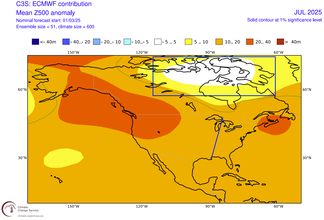
This shows a likely area of more unsettled summer weather over the eastern United States.
Looking at the temperature forecast, you can see the area of normal temperatures over the eastern United States and the southeast. This indicates the likely presence of at least some type of pressure disturbance, limiting the extended heatwave potential.
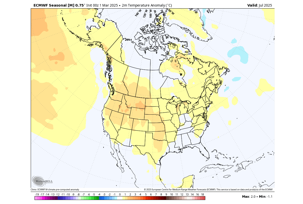
The strongest warm anomalies are forecast over the northwestern United States, with above-normal temperatures also across the Great Plains.
In the July precipitation forecast, you can see less rainfall than normal is forecast over the central and northern United States and southwestern Canada. More rainfall than usual is forecast over the southwestern United States and eastern Canada.
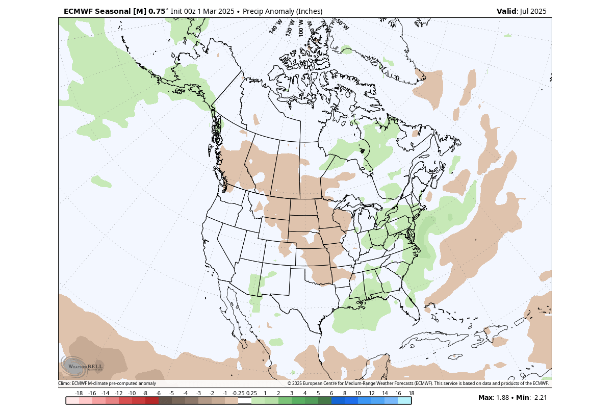
But a special case is the above-normal rainfall anomaly over the eastern United States. Overall, it shows a more unsettled weather pattern, indicating the presence of a pressure disturbance.
AUGUST 2025 FIRST FORECAST FOR NORTH AMERICA
August is statistically the final month of the meteorological summer season in the Northern Hemisphere. That is because it concludes the warmest 3-month period of the year, with September already seeing a drop in temperatures and the start of meteorological Autumn.
The pressure anomaly forecast for August shows a broader low-pressure zone over northern Canada. You can see two high-pressure areas, one over the North Pacific and one covering the northeastern United States and southeastern Canada.
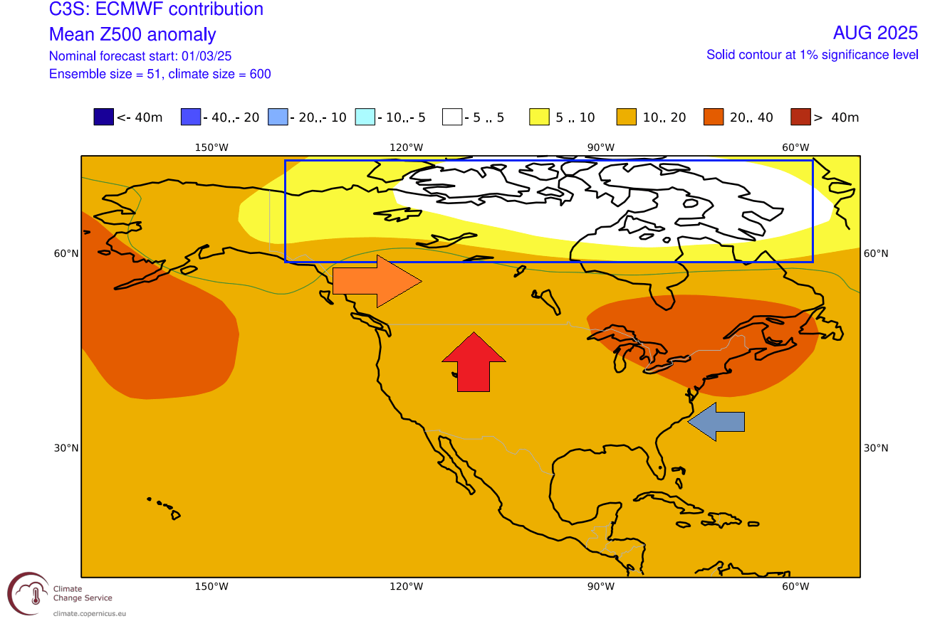
This configuration enables a warmer flow over the western and northern United States, and southwestern Canada. But it creates a more easterly flow over the eastern United States.
Looking at the temperature forecast, we see warmer-than-normal weather over a large part of the western and northern United States, under that warm flow, extending into southern Canada. But you can see weaker anomalies over the eastern United States, and even normal temperatures over the southeast.
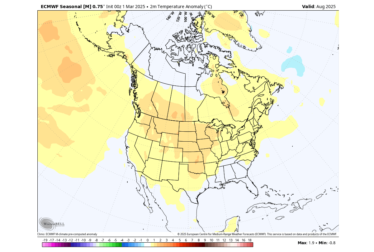
This forecast indicates a higher-than-normal potential for heatwaves in the western half of the United States. But over the eastern United States, an easterly flow would limit any strong and extended heat waves.
You can see a hint of this in the August precipitation forecast. Less precipitation than usual is forecast over the central and northern United States and southwestern Canada. But you can see more rainfall over the eastern United States and the northeast and over parts of eastern and northern Canada. This also indicates a limited potential for prolonged heatwaves in August over the eastern U.S.
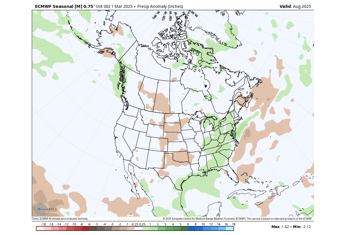
The forecast shows no significant rainfall anomalies over the western United States. But we do have to keep in mind that this forecast is 5 months into the future, so the strength of anomalies is always weaker with longer lead times.
To have some variety in the forecast, we usually also look at the latest official seasonal outlooks from NOAA.
OFFICIAL 2025 SUMMER FORECAST FOR THE U.S.
The NOAA official Summer temperature outlook shows that most of the United States is expected to be warmer than normal, apart from perhaps the northern Plains and upper half of the Midwest. The core warm anomalies are so far focused on the western parts of the United States and the far northeast.
This is not far from the model forecast above, which showed the strongest warm anomalies over the western half of the United States and a disturbance towards the eastern United States.
The official Summer precipitation outlook is closer to the model forecast. We see an equal-to-higher probability for more rainfall over the eastern United States and parts of the southwest. But we see below-normal precipitation forecast for the central and northwestern United States.
Both forecasts are very similar to the first model outputs, showing an agreement in the first trends for the Summer 2025 weather patterns over the United States.
Make sure to bookmark our page, so you don’t miss any latest weather forecasts and updates. Also, if you have seen this article in the Google App (Discover) feed, click the like button (♥) there to see more of our forecasts and our latest articles on weather and nature in general.
SEE ALSO:
La Niña effects the Spring, as an El Niño is on the Horizon in long-range predictions